


Simon Expected to Threaten Mexico as Major Hurricane
National Guard vehicles patrolled the streets of Puerto Vallarta as officers worked the waterfront with megaphones, calling out the few people still jogging, walking dogs, or biking by the shore. They reminded anyone left that the area was shut and urged them to take shelter. Not everyone followed the orders. To the passersby still moving along the water, the police repeated the instruction: “The boardwalk is closed. Be responsible. Understand!”
Tourists were still arriving despite the risks. Ricardo Ramirez and Brenda Villarreal had traveled from Guadalajara, Jalisco’s capital, on a four-day vacation planned since the year before. Neither had ever lived through a hurricane. Out searching for food along the boardwalk, they came across the same officers ordering people into shelter. Ramirez said the two of them were completely unprepared.
“We don’t know the extent of the danger yet,” Villarreal said. “We’re just starting to see what’s going on.”
Hotel worker Victor Martinez went shopping for nonperishable food on Sunday afternoon. Public transportation had been suspended and most of the hotel evacuated, so he could not go to work. He found people’s concerns about the hurricane comforting.
“It happened to us before. It hit us years ago,” Martinez said, referring to a Category 5 hurricane that struck the area in 2002. On the Saffir–Simpson hurricane wind scale, the ranking used for hurricanes in the eastern North Pacific, Category 5 is the highest step, reserved for storms with sustained winds of at least 157 mph. In 2002 that force had arrived against deep skepticism that such a storm would ever strike here.
“People didn’t expect it. We were very skeptical that it would ever hit us. Now, though, we’re different. Precautions are being taken. It happened to us once, and we won’t let it happen again.”
Sunday’s emptied hotel and stopped buses matched the change he described. What the present storm would bring to the west-central coast, and at what intensity, was the measure still waiting from the National Hurricane Center.
Senior National Hurricane Center specialist Phillipe Pappin stated the expectation without cushion. “We’re expecting catastrophic wind and life-threatening storm surge impacts along that west-central coast of Mexico where the hurricane warning is currently in effect,” he said. “They’re also getting very heavy rainfall associated with the storm that’s likely going to produce life-threatening flooding and mudslides in areas of higher terrain along the Mexican coastline, and there will be significant swells.”
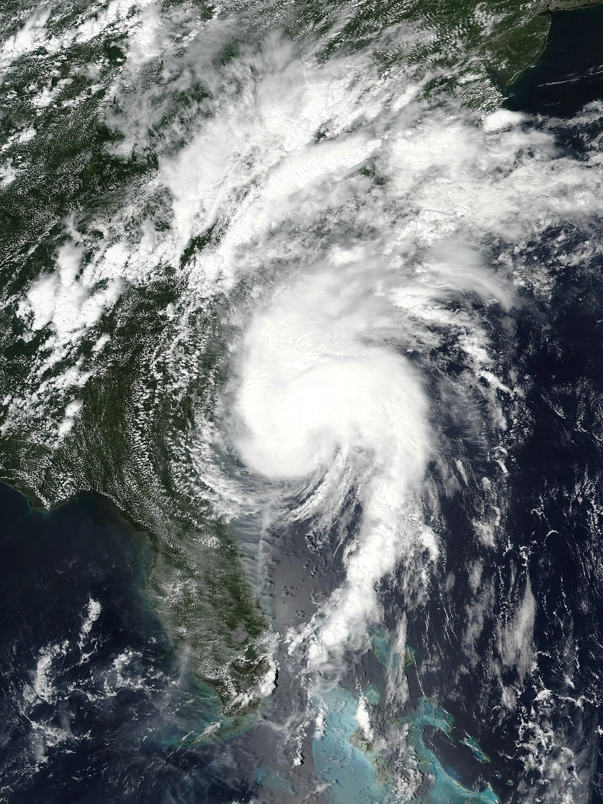
The hurricane warning ran from Punta San Telmo to El Roblito and Las Islas Marias. At 9 p.m. CST on Saturday, October 10, NHC Advisory 15 fixed Simon’s center 105 km south-southwest of Manzanillo with maximum sustained winds of 155 mph, or 250 km/h, and a minimum central pressure of 928 mb, or 27.41 inches. That made it a Category 4 major hurricane on the Saffir–Simpson scale—major meaning Category 3 or higher. In the eastern North Pacific the season runs from May 15 to November 30.

Pappin named Cabo Corrientes, the westernmost tip of mainland Mexico at the southern end of Bahia de Banderas, as the stretch most likely to take the hit. The eye remained offshore. The core was still moving toward the warning coast.
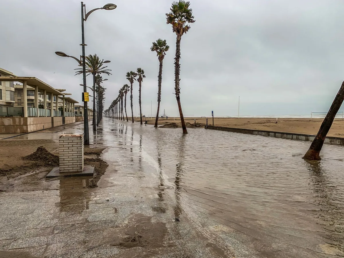
On Sunday morning in Manzanillo, residents waded through flooded streets while soldiers helped families bail water from their homes. Heavy rain had fallen overnight. At 6 p.m. CST on Friday, October 9, the center had been moving at 3 mph, or 6 kph.
Cecilia Palomar spoke outside her house. “The beds, the refrigerators, the stoves, all the furniture got wet. The whole house flooded,” she said. Her elderly mother had been taken to a brother’s place on higher ground and remained reluctant to stay away. “My mother doesn’t want to leave. We took her to my brother’s, to higher ground. She’s an elderly woman, but she doesn’t want to leave. She doesn’t want to be away from her home.”
Global News footage claimed winds of more than 240 km/h over the port. One resident said the toll began around 3 a.m., and that the water had never risen to such a high level in Manzanillo.
Jalisco had suspended classes on Friday and Monday in 22 coastal municipalities. Civil protection bulletins placed 28 municipalities across Jalisco and Colima under the highest cyclone alert level, while another 93 stood under high alert. Puerto Vallarta International Airport temporarily closed. Authorities suspended non-essential activities and opened emergency shelters in the threatened coastal communities. The rain was forecast across Colima, Jalisco, Nayarit, Sinaloa and Michoacan.
The National Hurricane Center expected Simon to produce an additional 5 to 10 centimeters of rain through early Thursday, with isolated areas receiving up to 20 centimeters. Separate figures put the further totals at 50 to 100 millimeters, with isolated amounts of 8 inches more and full storm totals that could reach 30 inches. “Isolated maximum storm totals of 76 cm are possible over portions of the states of Michoacan, Colima, and Jalisco,” the center said in its advisory. “This rainfall will produce life-threatening flooding and mudslides or worsen any on-going flooding, especially in areas of steep terrain.”
Seventy-six centimeters on steep ground was the number the coast now had to absorb while the core’s next miles were still being fixed.
Simon’s strength on Sunday did not settle on one number. Maximum sustained winds were reported at 205 km/h as a Category 3, at 130 mph in another accounting, and at 230 kph, or 145 mph, across other desks. At noon CST on Sunday, October 11, the National Hurricane Center placed the center 140 km west-northwest of Manzanillo and 100 km south-southeast of Cabo Corrientes, with winds of 140 mph, or 220 km/h, and motion of 7 mph, or 11 kph. By Sunday afternoon the Associated Press had the eye about 80 km south of Cabo Corrientes, still advancing at roughly 7 kph.
The center crawled parallel to the shore. The most damaging winds and rain for the Puerto Vallarta area were expected around midnight and through Monday morning. Forecasters called for additional weakening, yet still expected a strong hurricane near the west-central coast that night, then farther offshore on Monday before a possible turn back toward Mexico midweek. If the core moved fully onshore against the Sierra Madre, rapid weakening would follow.
The eye remained just offshore.