Transportation
Transit is the most used form of transportation every day in San Francisco. Every weekday, more than 560,000 people travel on Muni's 69 bus routes and more than 140,000 customers ride the Muni Metro light rail system. 32% of San Francisco residents use public transportation for their daily commute to work, ranking it fourth in the United States and first on the West Coast. The San Francisco Municipal Railway, primarily known as Muni, is the primary public transit system of San Francisco. As of 2023, Muni is the eighth-largest transit system in the United States.
The system operates a combined light rail and heavy rail (subway) system, the Muni Metro, as well as large bus and trolley coach networks. Additionally, it runs a historic streetcar line, which runs on Market Street from Castro Street to Fisherman's Wharf. It also operates the famous cable cars, which have been designated as a National Historic Landmark and are a major tourist attraction.
Bay Area Rapid Transit (BART), a regional Rapid Transit system, connects San Francisco with the East Bay and San Jose through the underwater Transbay Tube. The line, which contains all except the Orange Line, runs under Market Street to Civic Center where it turns south to the Mission District, the southern part of the city, and through northern San Mateo County, to the San Francisco International Airport, and Millbrae. BART also shares stations with SFMTA Muni Metro under Market Street.
Another commuter rail system, Caltrain, runs from San Francisco along the San Francisco Peninsula to San Jose. Historically, trains operated by Southern Pacific Lines ran from San Francisco to Los Angeles, via Palo Alto and San Jose.
Amtrak Thruway runs a shuttle bus from three locations in San Francisco to its station across the bay in Emeryville. Additionally, BART offers connections to San Francisco from Amtrak's stations in Emeryville, Oakland and Richmond, and Caltrain offers connections in San Jose and Santa Clara. Thruway service also runs south to San Luis Obispo with connection to the Pacific Surfliner.
San Francisco was an early adopter of carsharing in America. The non-profit City CarShare opened in 2001 and Zipcar closely followed.
San Francisco Bay Ferry operates from the Ferry Building and Pier 39 to points in Oakland, Alameda, Bay Farm Island, South San Francisco, Richmond, and north to Vallejo in Solano County. The Golden Gate Ferry is the other ferry operator with service between San Francisco and Marin County. SolTrans runs supplemental bus service between the Ferry Building and Vallejo.
To accommodate the large amount of San Francisco citizens who commute to the Silicon Valley daily, employers like Genentech, Google, and Apple have begun to provide private bus transportation for their employees, from San Francisco locations. These buses have quickly become a heated topic of debate within the city, as protesters claim they block bus lanes and delay public buses.
In 2014, only 41.3% of residents commuted by driving alone or carpooling in private vehicles in San Francisco, a decline from 48.6% in 2000. There are 1,088 miles of streets in San Francisco with 946 miles of these streets being surface streets, and 59 miles of freeways. Due to its unique geography, and the freeway revolts of the late 1950s,
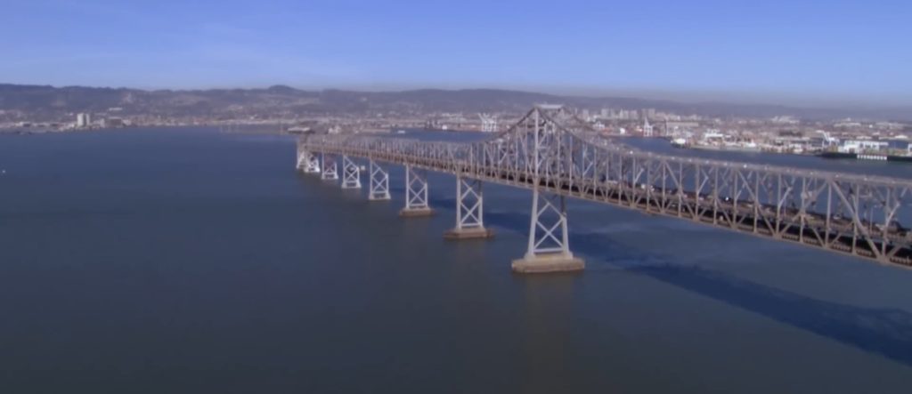
I-80 begins at the approach to the Bay Bridge and is the only direct automobile link to the East Bay. US 101 connects to the western terminus of I-80 and provides access to the south of the city along San Francisco Bay toward Silicon Valley. Northward, the routing for US 101 uses arterial streets to connect to the Golden Gate Bridge, the only direct automobile link to Marin County and the North Bay.
As part of the retrofitting of the Golden Gate Bridge and installation of a suicide barrier, starting in 2019 the railings on the west side of the pedestrian walkway were replaced with thinner, more flexible slats in order to improve the bridge's aerodynamic tolerance of high wind to 100 mph (161 km/h). Starting in June 2020, reports were received of a loud hum produced by the new railing slats, heard across the city when a strong west wind was blowing.
SR 1 also enters San Francisco from the north via the Golden Gate Bridge and bisects the city as the 19th Avenue arterial thoroughfare, joining with I-280 at the city's southern border. I-280 continues south from San Francisco, and also turns to the east along the southern edge of the city, terminating just south of the Bay Bridge in the South of Market neighborhood. After the 1989 Loma Prieta earthquake, city leaders demolished the Embarcadero Freeway and a portion of the Central Freeway, converting them into street-level boulevards.
SR 35 enters the city from the south as Skyline Boulevard and terminates at its intersection of Highway 1. SR 82 enters San Francisco from the south as Mission Street, and terminates shortly thereafter at its intersection of I-280. The western terminus of the historic transcontinental Lincoln Highway, the first road across America, is in San Francisco's Lincoln Park.
In 2014, San Francisco committed to Vision Zero, with the goal of ending all traffic fatalities caused by motor vehicles within the city by 2024. San Francisco's Vision Zero plan calls for investing in engineering, enforcement, and education, and focusing on dangerous intersections. In 2013, 25 people were killed by car and truck drivers while walking and biking in the city and 9 car drivers and passengers were killed in collisions. In 2019, 42 people were killed in traffic collisions in San Francisco.
Though located 13 miles (21 km) south of downtown in unincorporated San Mateo County, San Francisco International Airport (SFO) is under the jurisdiction of the City and County of San Francisco. SFO is a hub for United Airlines and Alaska Airlines. SFO is a major international gateway to Asia and Europe, with the largest international terminal in North America. In 2011, SFO was the eighth-busiest airport in the U.S. and the 22nd-busiest in the world, handling over 40.9 million passengers.
Located in the South Bay, the San Jose International Airport (SJC) is the second-busiest airport in the Bay Area, followed by Oakland San Francisco Bay Airport, which is a popular, low-cost alternative to SFO.
Cycling is a popular mode of transportation in San Francisco, with 75,000 residents commuting by bicycle each day. In recent years, the city has installed better cycling infrastructure such as protected bike lanes and parking racks. Bay Wheels, previously named Bay Area Bike Share at inception, launched in August 2013 with 700 bikes in downtown San Francisco, selected cities in the East Bay, and San Jose. The San Francisco Municipal Transportation Agency and Bay Area Air Quality Management District are responsible for the operation with management provided by Motivate. A major expansion started in 2017, along with a rebranding as Ford GoBike; the company received its current name in 2019.
Pedestrian traffic is also widespread. In 2021, Walk Score ranked San Francisco the most walkable city in the United States.
San Francisco has significantly higher rates of pedestrian and bicyclist traffic deaths than the United States on average. In 2013, 21 pedestrians were killed in vehicle collisions, the highest since 2001, which is 2.5 deaths per 100,000 population – 70% higher than the national average of 1.5.
Cycling is becoming increasingly popular in the city. The 2010 Municipal Transportation Agency (MTA) annual bicycle count showed the number of cyclists at 33 locations had increased 58% from the 2006 baseline counts. In 2008, the MTA estimated that about 128,000 trips were made by bicycle each day in the city, or 6% of total trips.
As of 2019, 2.6% of the city's streets have protected bike lanes, with 28 miles of protected bike lanes in the city. Since 2006, San Francisco has received a Bicycle Friendly Community status of "Gold" from the League of American Bicyclists. In 2022 a measure on the ballot passed to protect JFK drive in Golden Gate Park as a pedestrian and biking space with 59% of voters in favor.